Projects:
|
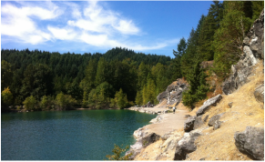
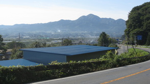
Active tectonics on Vancouver Island: A multi-institute, international collaborative project to quantify the accommodation of strain in the upper plate of the Cascadia subduction zone in SW British Columbia. These faults pose a currently uncharacterized potential source of shallow seismicity, and quantification of the timing, magnitude and kinematics of paleo-ruptures is necessary for informing local building practices. This project involves the combination of structural analyses, mapping of fault scarps and offset surficial deposits, paleosiesmic trenching, and quantification of landscape response to active faulting.
|
|
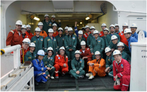
Plate boundary and forearc structure in the vicinity of the 2011 Tohoku M9 earthquake: The 2011 Tohoku earthquake produced an unprecedented ~50m slip along the plate boundary near the trench. This large, shallow displacement contributed to the tsunami that devastated northern Honshu. As part of IODP Exp 343, we have been investigating the structure of the plate boundary and frontal prism, to understand the processes that promoted such large shallow slip. In particular I have been using meteoric 10-Be to determine the age of sediments in the frontal prism, identify fault inversions, and estimate mass balance of accreted and subducted sediments. Quantification of sediment inputs at the trench is critical for understanding the composition, frictional properties, and fluid properties of the decollement at depth.
|
|
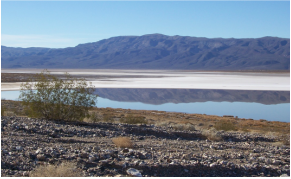
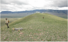
Holocene Rupture history, ECSZ: The recognition of temporal clustering of earthquakes in Eastern California Shear Zone (ECSZ) and San Andreas fault has raised questions about the lateral extent over which clustered earthquakes occur in California, and what processes control non-steady release of seismic moment. Currently, we are combining mapping of offset alluvial fans and soil chronostratigraphy to quantify the Holocene rupture history of the Ash Hill fault, as part of a broader investigation of clustered seismicity on fault systems in the northern ECSZ.
|
|
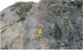
Effect of Seamount subduction on fault geometry and rupture propagation: The subduction of seamounts and other seafloor bathymetric highs is common, but there is considerable debate as to when and where these features act as sites of earthquake nucleation or as barriers to seismic rupture. Geophysical data suggest that the fault zone surrounding subducted seamounts may be geometrically complex, but direct observations of the thrust contact of actively subducting seamounts is not currently feasible. This projects goals are to document the structural, frictional, and mechanical properties of the fault zone contact through field investigations of ancient accreted seamounts, in order to test conceptual models of fault behavior in the vicinity of subducted seamounts.
|
Past Projects:
|
Forearc crustal tectonics and implications for subduction erosion in NE Japan: Subduction erosion, a process by which crustal material is tectonically removed from the upper plate, has been proposed to occur at nearly 50% of the world’s subduction zones. One of the strongest lines of evidence used to infer subduction erosion is widespread subsidence of the outer forearc. We find evidence in Japan, and several western Pacific margins, that outer forearc subsidence occurred during periods of upper plate extension and back-arc rifting, coeval with an acceleration in local plate convergence rate. These data suggest that a large quantity of the subsidence previously thought to result from tectonic erosion may rather be the forearc's response to dynamic changes in slab geometry during periods of backarc extension.
|
|
Paleoseismicity in the northern Basin and Range: This project is in collaboration with the US Bureau of Reclamation to quantify the timing, magnitude and kinematics of late Pleistocene - Holocene earthquakes in the Red Rock valley. Two active faults in the valley project into an earthen dam across the Red Rock River. In order to assess dam safety in the event of an earthquake, we are working to quantify the paleoseismic history, kinematics, and subsurface geometry of these faults. This project has involved surficial mapping of fault scarps and offset alluvial fans, and paleoseismic trenching.
|
